What can be built on any parcel
Zoning districts overlaid on the map. Click any zone for classification, allowed uses, and building restrictions.
Search an address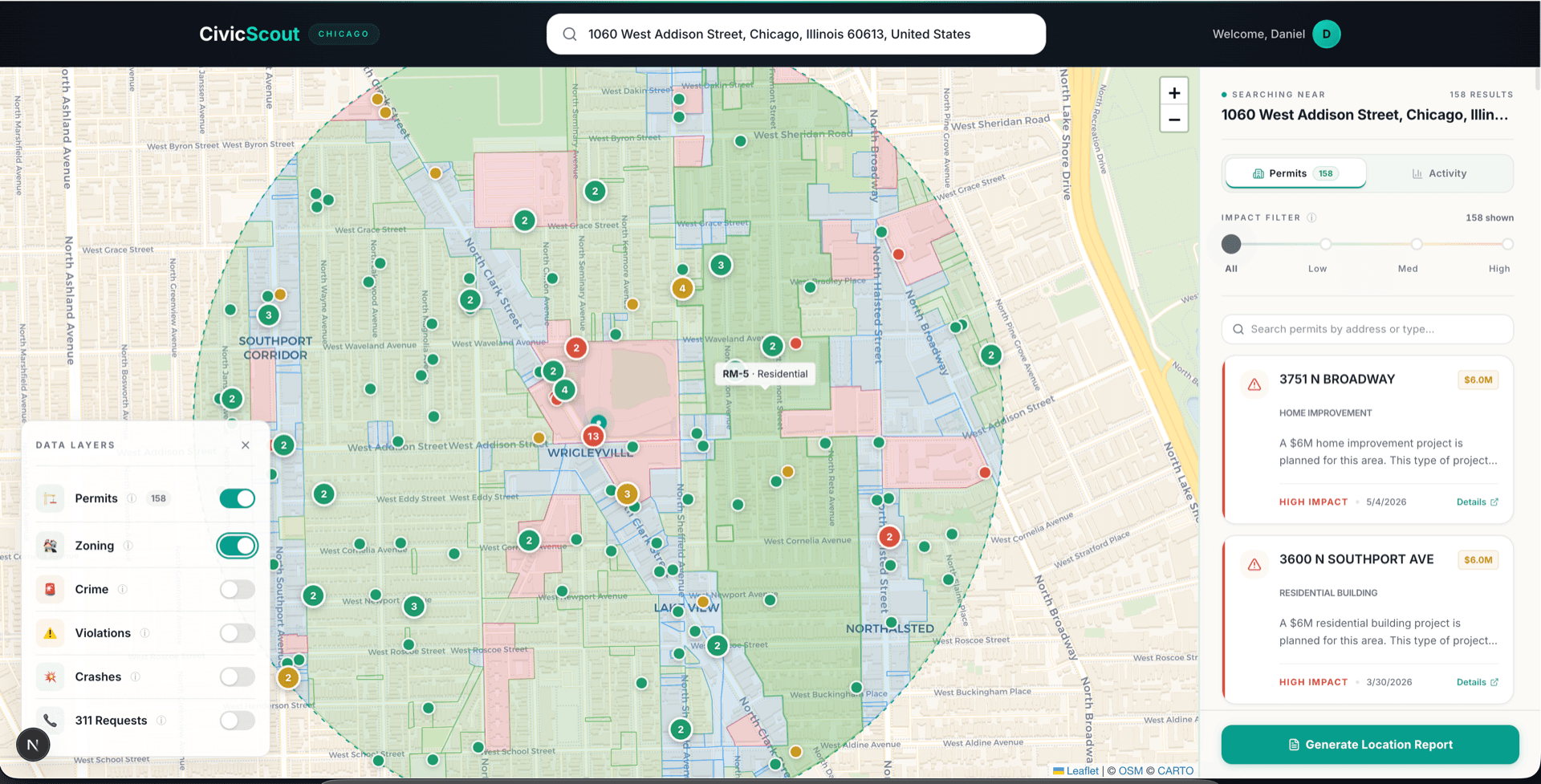
Check a parcel's zoning in three steps
Toggle the zoning layer
Click any zone
Cross-reference with permits
What the zoning layer tells you
District classifications
Every parcel in Chicago has a zoning designation. We map them all — from RS-3 single-family residential to DX-16 downtown mixed-use. Click any zone to understand exactly what it means for the property and the neighborhood.
Allowed uses and restrictions
Each zoning district comes with a detailed breakdown: what can be built, what's prohibited, maximum building height, lot coverage limits, and required setbacks. Essential information for investors evaluating development potential.
Development potential
Cross-reference zoning with permit activity to understand where development is heading. A parcel zoned for multi-unit in an area with active construction permits tells a different story than one in a quiet residential block.
Explore zoning for any address
Search any Chicago address to see zoning districts, allowed uses, and building restrictions.